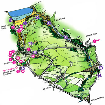
- The Walks
 Walk 1 - St.Agnes Village Trail
 Walk 2 - St Agnes Beacon
 Walk 3 - Porthtowan, Banns Vale, Mount Hawke and Chapel Porth
 Walk 4 - Wheal Rose, The Poldice Plateway and Mawla
 Walk 5 - Mount Hawke
 Walk 6 - Mithian
 Walk 7 - Wheal Coates, Chapel Porth, Wheal Lawrence Valley and Goonvrea
 Walk 8 - Water Lane, Wheal Butson and Jericho Valley
 Walk 9 - Jericho Valley and Cross Coombe
 Walk 10 - Blackwater
Walk 8 - Water Lane, Wheal Butson and Jericho Valley
Having reached a road at the top, turn left. From this road the view to the left is out- standing, although it does not appear to be high it gives a panoramic view of the countryside from Wheal Kitty to the north round to the wind-turbines at Carland Cross and the massive "mountains" of pit spoils in the clay country around St Austell to the east. Soon the road starts to descend to a bridge across a stream. It then sweeps right and climbs quite steeply before a branch to the left is seen. Take this left turn. (Instead of following the road around this steep corner you can take a short-cut by turning left shortly after the bridge and climbing up and over a steep, rocky hillock. Turn left as you rejoin the road.)
 After the short, steep climb at the
corner this pleasant road becomes
more tree-lined as it makes a gentle
descent. After about 1/4 of a mile, as
the road starts to ascend, we can see
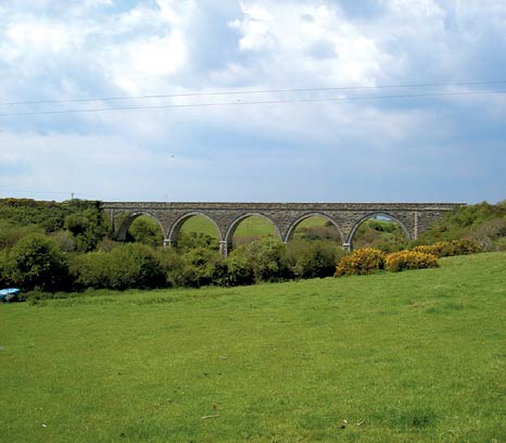
on our left an even greater reminder of
the dead railway C. A magnificent
viaduct straddles the valley. Then a
lane to the left, clearly marked
Liberty House, is to be found. It looks
very private but is the course of a public
After the short, steep climb at the
corner this pleasant road becomes
more tree-lined as it makes a gentle
descent. After about 1/4 of a mile, as
the road starts to ascend, we can see
on our left an even greater reminder of
the dead railway C. A magnificent
viaduct straddles the valley. Then a
lane to the left, clearly marked
Liberty House, is to be found. It looks
very private but is the course of a public 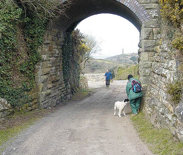 footpath; turn down this lane. On our way down we pass under a railway bridge D that is so
close to the viaduct that it almost seems like a sixth arch. Then, when the lane splits to serve the two
adjacent houses, a footpath sign on the right points to a well delineated path that skirts round the
guesthouse, Liberty
footpath; turn down this lane. On our way down we pass under a railway bridge D that is so
close to the viaduct that it almost seems like a sixth arch. Then, when the lane splits to serve the two
adjacent houses, a footpath sign on the right points to a well delineated path that skirts round the
guesthouse, Liberty 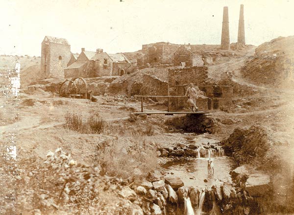 House. Take this path. Continue by a tree-lined descending path into a thicker wooded
stretch. On the way down the path crosses a stream by a small footbridge. Our path now follows that stream
on its way to the sea although it is not always visible in the thick woodland. The path then meets the
Perranporth road at Barkla Shop. Cross
the road to the path at the other side
but take great care as fast cars may roar
around the blind corner on the right.
House. Take this path. Continue by a tree-lined descending path into a thicker wooded
stretch. On the way down the path crosses a stream by a small footbridge. Our path now follows that stream
on its way to the sea although it is not always visible in the thick woodland. The path then meets the
Perranporth road at Barkla Shop. Cross
the road to the path at the other side
but take great care as fast cars may roar
around the blind corner on the right.
We are now entering Jericho Valley; our
path is another pretty woodland walk but
it wasn't always like this . This is the
beginning of what was a very active tin
mining area. Over the 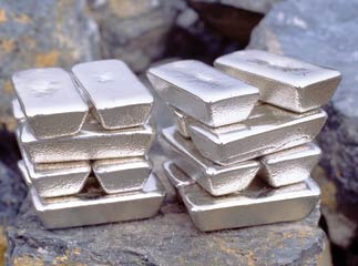 years nature has
fought back to hide the scars caused by
both the dumping of the discarded spoils
of the industry and the devastation
caused by the surface workings. In the
main it is now covered by trees or a
mixture of gorse, heather and fern.
as it leads down to join a lane. Follow the
path to the junction with a lane, turn
right
years nature has
fought back to hide the scars caused by
both the dumping of the discarded spoils
of the industry and the devastation
caused by the surface workings. In the
main it is now covered by trees or a
mixture of gorse, heather and fern.
as it leads down to join a lane. Follow the
path to the junction with a lane, turn
right 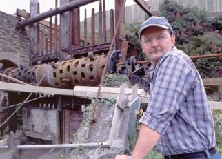 and after a few strides turn right
again over a bridge. Now follow the
stream by taking the path to the left. This part is heavily wooded but leads on to a more open, steeply sided valley. This dreamy path with its
tinkling water accompaniment leads to what is the very last tin producing establishment in Cornwall, The Blue
Hills Tin Streams. Their buildings are to seen on the left of the path. F This cottage industry is run by a father
and son who not only produce the tin but turn it into jewellery and souvenirs. They also give demonstrations
of the many processes necessary to turn
ore into the bright, shiny metal. The
engine house of the old Blue Hills mine is
to be found on the right just as the path
joins the road. This point also gives us
our first glimpse of the sea in the vee of
the valley as it opens into Trevellas Porth.
and after a few strides turn right
again over a bridge. Now follow the
stream by taking the path to the left. This part is heavily wooded but leads on to a more open, steeply sided valley. This dreamy path with its
tinkling water accompaniment leads to what is the very last tin producing establishment in Cornwall, The Blue
Hills Tin Streams. Their buildings are to seen on the left of the path. F This cottage industry is run by a father
and son who not only produce the tin but turn it into jewellery and souvenirs. They also give demonstrations
of the many processes necessary to turn
ore into the bright, shiny metal. The
engine house of the old Blue Hills mine is
to be found on the right just as the path
joins the road. This point also gives us
our first glimpse of the sea in the vee of
the valley as it opens into Trevellas Porth.
 Contact Us
Site Map
Concept by Graeme and Rust
Build by uknetweb