
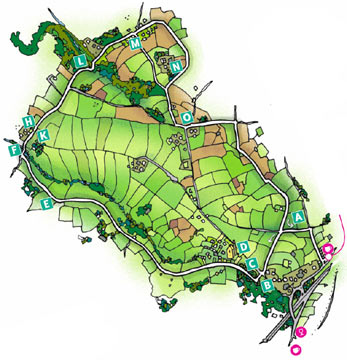
- The Walks
 Walk 1 - St.Agnes Village Trail
 Walk 2 - St Agnes Beacon
 Walk 3 - Porthtowan, Banns Vale, Mount Hawke and Chapel Porth
 Walk 4 - Wheal Rose, The Poldice Plateway and Mawla
 Walk 5 - Mount Hawke
 Walk 6 - Mithian
 Walk 7 - Wheal Coates, Chapel Porth, Wheal Lawrence Valley and Goonvrea
 Walk 8 - Water Lane, Wheal Butson and Jericho Valley
 Walk 9 - Jericho Valley and Cross Coombe
 Walk 10 - Blackwater
Walk 4 - Wheal Rose, The Poldice Plateway and Mawla
 Turn right onto the road, go downhill and cross a stream F; continue uphill past Mawla chapel.
Mawla is actually a very early area of settlement, although almost nothing remains to be seen, many ancient
artifacts have been found which now rest in the museum in Truro. These include Iron Age worked stones, a
quernstone, fragments of stone vessels, a drilled shaped stone and also spindle whorls of unknown date.
Nearby there was a flint-working site and early
Turn right onto the road, go downhill and cross a stream F; continue uphill past Mawla chapel.
Mawla is actually a very early area of settlement, although almost nothing remains to be seen, many ancient
artifacts have been found which now rest in the museum in Truro. These include Iron Age worked stones, a
quernstone, fragments of stone vessels, a drilled shaped stone and also spindle whorls of unknown date.
Nearby there was a flint-working site and early 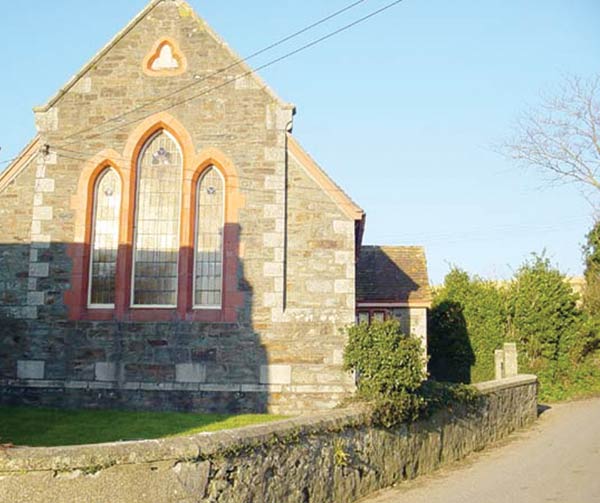 maps show several Bronze Age barrows in the vicinity of
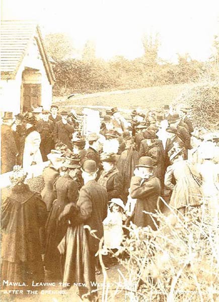
Mawla Chapel H. The current Chapel was built H in 1908 and opened just a year later, much of the work being done by the local congregation
I and J. It replaced a smaller earlier
chapel located on the right, just a few
metres up the hill on the opposite side of
the road, where the Sunday school was
then
maps show several Bronze Age barrows in the vicinity of
Mawla Chapel H. The current Chapel was built H in 1908 and opened just a year later, much of the work being done by the local congregation
I and J. It replaced a smaller earlier
chapel located on the right, just a few
metres up the hill on the opposite side of
the road, where the Sunday school was
then 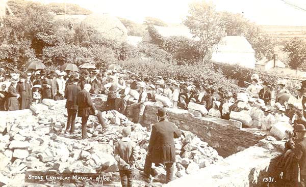 based K. Mawla at one time was a
much more wooded area but suffered
heavily when Dutch Elm disease swept
through the United Kingdom.
based K. Mawla at one time was a
much more wooded area but suffered
heavily when Dutch Elm disease swept
through the United Kingdom.
 Continue up the hill and ignoring the
road junction on the left, at a right
hand bend take the track on the left.
After about 50 metres, just before a
bend in the track, take the stile on the
right, this is set into the hedge and
easily missed but is indicated by a
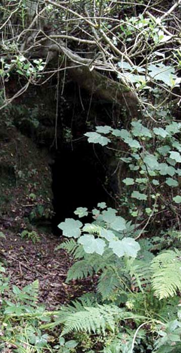
small arrow on a post. Descend
through woodland observing the adit
on the right at the bottom L. This used
to drain the Stencoose and Mawla United
mines, which again had flooding
problems, having an engine that was too
small to cope with the water. There are
stepping-stones across the small rill from
the adit and a plank bridge over the
adjacent stream. Cross the
Continue up the hill and ignoring the
road junction on the left, at a right
hand bend take the track on the left.
After about 50 metres, just before a
bend in the track, take the stile on the
right, this is set into the hedge and
easily missed but is indicated by a
small arrow on a post. Descend
through woodland observing the adit
on the right at the bottom L. This used
to drain the Stencoose and Mawla United
mines, which again had flooding
problems, having an engine that was too
small to cope with the water. There are
stepping-stones across the small rill from
the adit and a plank bridge over the
adjacent stream. Cross the 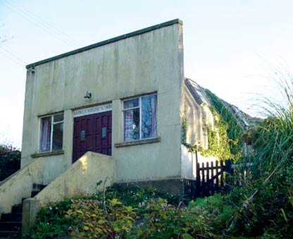 road and go
up the road opposite, this hamlet is
called Manor Parsley.
road and go
up the road opposite, this hamlet is
called Manor Parsley.
 Continue up the hill past the bungalows
on the right; look for a bungalow on the
right with an interwoven fence atop a
stone wall, opposite 'Little Oaks.' There
is a track to the right here M, one can take
this track and shorten the walk by 3/4 mile - also this is an advisable route in wet
weather conditions for those without stout
boots, as the longer route can be muddy.
Continue up the hill past the bungalows
on the right; look for a bungalow on the
right with an interwoven fence atop a
stone wall, opposite 'Little Oaks.' There
is a track to the right here M, one can take
this track and shorten the walk by 3/4 mile - also this is an advisable route in wet
weather conditions for those without stout
boots, as the longer route can be muddy.
 Contact Us
Site Map
Concept by Graeme and Rust
Build by uknetweb