- The Walks
 Walk 1 - St.Agnes Village Trail
 Walk 2 - St Agnes Beacon
 Walk 3 - Porthtowan, Banns Vale, Mount Hawke and Chapel Porth
 Walk 4 - Wheal Rose, The Poldice Plateway and Mawla
 Walk 5 - Mount Hawke
 Walk 6 - Mithian
 Walk 7 - Wheal Coates, Chapel Porth, Wheal Lawrence Valley and Goonvrea
 Walk 8 - Water Lane, Wheal Butson and Jericho Valley
 Walk 9 - Jericho Valley and Cross Coombe
 Walk 10 - Blackwater
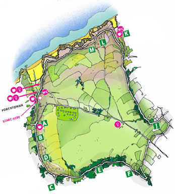
Walk 3 - Porthtowan, Banns Vale, Mount Hawke and Chapel Porth
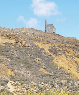 Turn left onto an unmade track and after about 50 metres the lane divides; keep to the right hand lane. Before you go any further, a little history about Tywarnhayle Mine D, which is to your left up at the top. This mine has a chequered history, being at its most prosperous in the late 1830s and, in the period 1826-52, 68,000 tons of copper ore were raised. It then went through a difficult time but was reopened in 1906 when a Power House was erected using coal from Portreath to manufacture gas to power the generators, but the Company went into liquidation in 1907. Since 1908, apart from a period during the Second World War, Tywarnhayle was used for training mining students. It is possible to visit the engine house, but the path is steep and overgrown, so we will continue our walk!!
Continuing the walk on the lower right hand lane, you will pass a water treatment works on the right. You will then reach an open grass area with a stream which you will have to cross, but be careful as the stepping stones can be slippery.
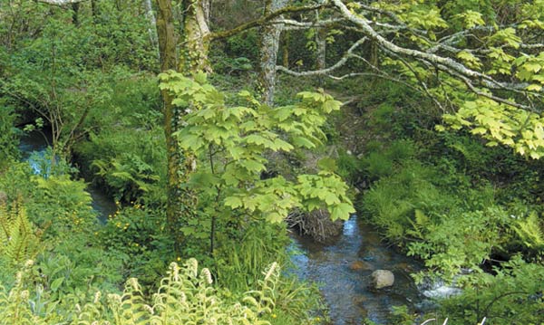 Turn left where the path continues by the stream along a tranquil, beautiful bridleway known as Parc Shady E. As it is a bridleway it can be muddy. As the trees ahead appear to thin out leading to cultivated land which is Banns Farm, on the right there is a small tunnel with water emerging F, which is reported to be an adit (drainage
 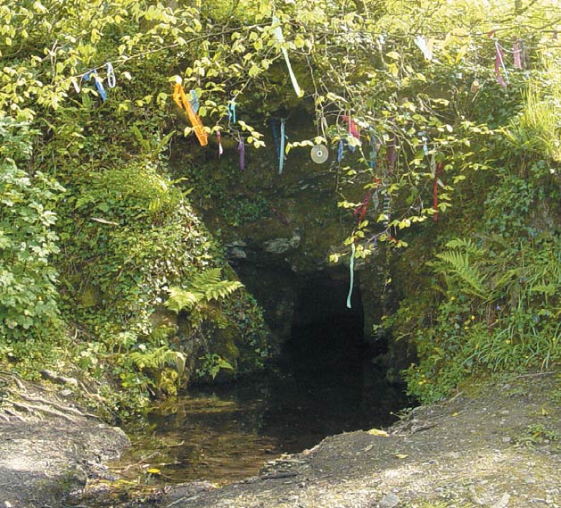 channel) belonging to a small mine called Wheal Banns. The ribbons and personal effects strung here are gifts to spirits, the more personal the token to the wisher the more potent the wish, in return for which a wish comes true when the gift returns to nature.
Shortly after, the path branches, take the left hand fork and you will reach the road where you turn left, it does mean you now have about half a mile road walking, but on a quiet road.
 This area is Banns Vale, the meaning of Banns is 'hollow' and you can understand this as you walk up the hill. You get a clear view of St.Agnes Beacon G in front of you with the engine house of Wheal Coates on the skyline H to the left and if you turn round you will see
 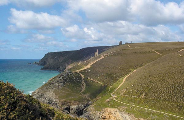 Carn Brea I.
When you reach the road (be very careful as this is busy) cross over and take the lane opposite. Walk down this lane keeping to the right of two cottages until you reach another stream which you need to cross and then climb over a stile. Turn right and walk round the edge of the field until you see a stile in the hedge on  the right. Go over this and then keep near the hedge on your left until you reach another stile; cross this and you are now on a tarmac road. Turn left and continue until you reach a junction with a converted Chapel facing you. Turn left and walk down the road through the hamlet of Mingoose J. This means 'edge of the wood' and you will pass old cottages on your left, one of which was The Miners Arms but hasn't served a pint since about 1800!!
 Contact Us
Site Map
Concept by Graeme and Rust
Build by uknetweb